National Weather Service Update — Life-Threatening Flooding for Guadalupe River Basin Still Possible
As of 7 a.m., CST, the National Weather Service is still predicting another 2-4 inches of rain across Victoria and Calhoun counties. The storm, however, is now moving east -- which is good news locally, but horrible news for Houston -- which is now facing up to 50 inches of rain.
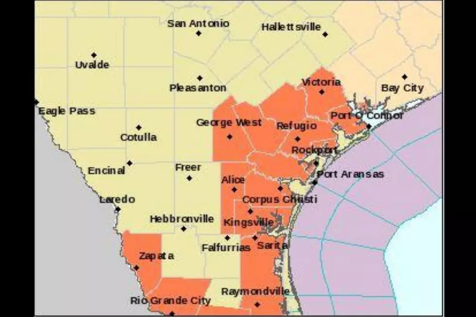
Our listening area remains under a flash flood watch until Tuesday (8/29) at 7 a.m. The tropical storm warning in effect will remain that way "until further notice."
It's also not great for the Guadalupe River Basin as all that rain starts to drain south toward the Gulf.
Matagorda County (south of FM251), Aransas County and Calhoun County remain under mandatory evacuations, according to ABC 13 in Houston. Matagorda County, especially, is looking at as much as 10 FEET of rain today.
A seven-day forecast shows rains chances being heaviest tonight (8/28) and decreasing as we move toward Wednesday.
The full release from the National Weather Service is below:
...Flash Flood Watch remains in effect for Goliad, Victoria, Calhoun...
...Tropical Storm Warning remains in effect from Mesquite Bay to Port O'Connor, including the adjacent coastal counties...
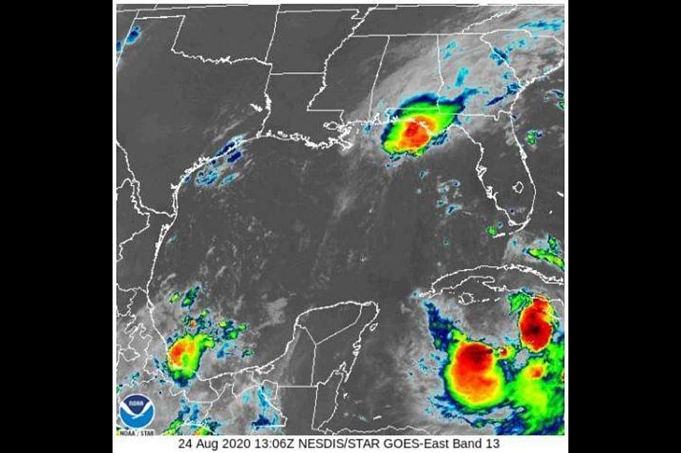
Tropical Storm Harvey nearing Port O'Connor as it moves slowly southeast into the Gulf of Mexico. Gusty northwest winds are expected as Harvey moves into the Gulf.
The heaviest rains have shifted east of the Houston Area. Multi-day totals could reach 50" in the Houston area. Our heavy rainfall threat has decreased and shifted east. Localized accumulations of 2 to 4 inches still possible across Victoria and Calhoun Counties.
We are most concerned about the Guadalupe River basin where Life Threatening Flooding is still possible. Major flooding expected in several locations.
More From Q92